Recherche par Projets
REMAKE - Seismic Risk in Ecuador: Mitigation, Anticipation and Knowledge of Earthquakes - ANR 2016
- Détails
 Le projet REMAKE, soutenu par l'ANR, propose le développement d’un modèle de prédiction probabiliste des forts séismes en Equateur et au Nord-Pérou, une région régulièrement frappée par des séismes destructeurs comme celui de Pedernales le 16 Avril 2016. L’originalité de l'approche est d’intégrer l’ensemble des connaissances sur la zone - tectoniques, sismologiques, géodésiques, sociétales -, pour quantifier le potentiel sismogène des principales failles et anticiper les risques sociétaux et environnementaux.
Image : Ville de Quito
SISMED - InveStigation par l’Imagerie Sismique de failles sismogènes profondes en MEDiterranée
- Détails
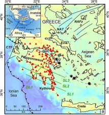
Le projet SISMED a pour objectif de caractériser un système majeur de failles sismiques situé en Méditerranée (Grèce), grâce à une campagne d’imagerie sismique réalisée par le navire de recherche océanographique américain ultra sophistiqué, le R/V Marcus Langseth. Cette opération à bord de ce navire américain sera une première en Europe. Les travaux de recherche du projet SISMED contribueront à la prévention des risques sismiques et des risques liés aux tsunamis en Grèce et sur le pourtour méditerranéen.
E-POST - The Early POSTseismic Deformation - ANR JC 2015
- Détails
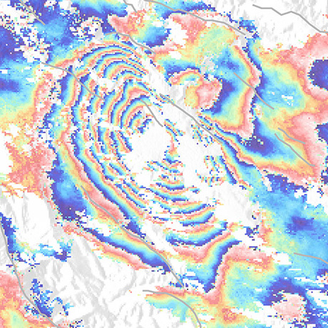 The Early POSTseismic Deformation: a Key Process in the Earthquake Cycle. From Observation to Modeling.
The main objective of the project is to better understand the complex space and time evolution of postseismic transient processes to better assess their link with the coseismic processes and how they contribute to the stress redistribution, which might lead to the generation of catastrophic seismic sequences. The originality of the project is to focus on the shorter time scale of the postseismic phase, the transition from the co- to postseismic (i.e. early postseismic, from minutes to early days) and to test to what extent the better description and knowledge of the co- and early postseismic deformation help to resolve the longer time-scale postseismic deformation (months - years).
The E-POST Young Researcher project is supported by the main French Research Funding Agency ANR over the period 2015-2019.
HYDROSEIS - In-Situ Study of Fluid-Induced Earthquakes and Aseismic Slip - ANR 2014
- Détails
 Fig. Fluid pressure diffusion along a strike-slip fault Fig. Fluid pressure diffusion along a strike-slip fault |
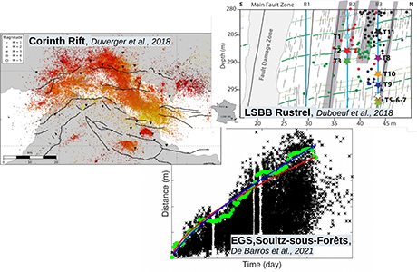
The HYDROSEIS project's main objective is to improve our understanding of the role of fluids on the rupture of earthquake faults. To date, few data are available to study the couplings between fluids, fault slip and seismicity. In this project, we propose to develop a new in-situ approach based on the hydraulic stimulation of a small fault segment (10 m) under controlled experimental conditions. The fluid injections will produce small fault slip (few millimeters) and will be monitored with a dense network of sensors, including pressuremeters, strainmeters, seismometers and electrical imaging. This original experiment will be conduct at 300 m-depth at the Low Noise Underground Laboratory of Rustrel in France. |
UMR Géoazur
Campus Azur du CNRS
250 rue Albert Einstein
- CS 10269 - F 06905 SOPHIA ANTIPOLIS Cedex
+33 (0)483 618 500


